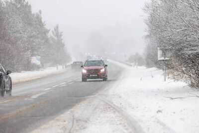
Weather charts for the UK indicate that as many as 30 counties could experience snow in the coming weeks as the Met Office cautions of a "more changeable or unsettled spell of weather".
Recent maps from WXCharts, which draws on MetDesk data, indicate that between May 6 (Wednesday) and May 8 (Friday) areas of Scotland, northern England and Wales may experience snow showers or a thin covering of snow.
The chillier, more wintry period is anticipated to arrive after a stretch of predominantly dry conditions sustained by high pressure, delivering a combination of sunshine and cloud throughout late April and into early May, according to the Met Office.
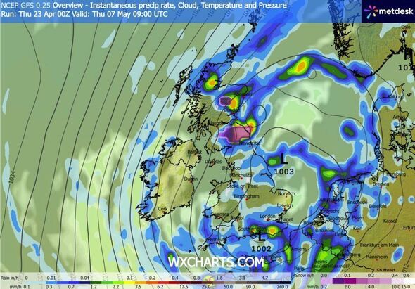
WXCharts projections show swathes of persistent rain moving across large portions of the nation around midday on Wednesday, May 6. Nevertheless, purple colouring - signifying snow - indicates areas of Scotland, notably on elevated terrain, together with certain regions of Northern England, particularly the Pennines, may witness snowfall as temperatures fall.
By the evening of May 6, the heaviest of the rainfall is anticipated to move away, leaving isolated showers in western regions of the country. Nevertheless, the Grampians and Snowdonia may still experience some snow by approximately 9pm.
Moving into the morning of May 7, a thin covering is forecast over the Grampians - with some snow persisting into May 8 - together with areas of southern Scotland.
The list below identifies the counties expected to experience snow between May 6 and May 8, according to the most recent charts:
- Argyll and Bute
- Aberdeenshire
- Aberdeen City
- Moray
- Angus
- Fife
- Highland
- Stirling
- East Lothian
- Clackmannanshire
- Perth and Kinross
- Dunbartonshire
- Glasgow City
- Renfrewshire
- Inverclyde
- North Lanarkshire
- South Lanarkshire
- East Ayrshire
- North Ayrshire
- South Ayrshire
- Dumfries and Galloway
- Cumbria
- Tyne and Wear
- County Durham
- Northumberland
- North Yorkshire
- Powys
- Gwynedd
- Conwy
In its extended forecast covering Thursday, May 7, to Thursday, May 21, the Met Office warns: "A generally more changeable or unsettled spell of weather compared to the previous couple of weeks.
"This comes about as Atlantic low-pressure systems move towards the UK, increasing the chance of periods of heavy rain and perhaps strong winds at times.
"Towards the middle of the month, weather patterns become increasingly uncertain; however, the wettest and windiest conditions seem most likely to be in the northwest, with the drier and more settled conditions in the southeast. Temperatures will likely be near or a little above normal overall."
Contact to : xlf550402@gmail.com
Copyright © boyuanhulian 2020 - 2023. All Right Reserved.